Santa Monica Mountains Running
BBT: 0/8 complete | 5 partial | ~20.5 of ~67 mi covered (30.6%)
Backbone Trail
The Santa Monica Mountains Backbone Trail runs ~67 miles from Will Rogers State Historic Park (Pacific Palisades) east terminus west to Point Mugu State Park. Goal: run every mile of every segment, in aggregate.
BBT: 0/8 complete | 5 partial | ~20.5 of ~67 mi covered (30.6%)
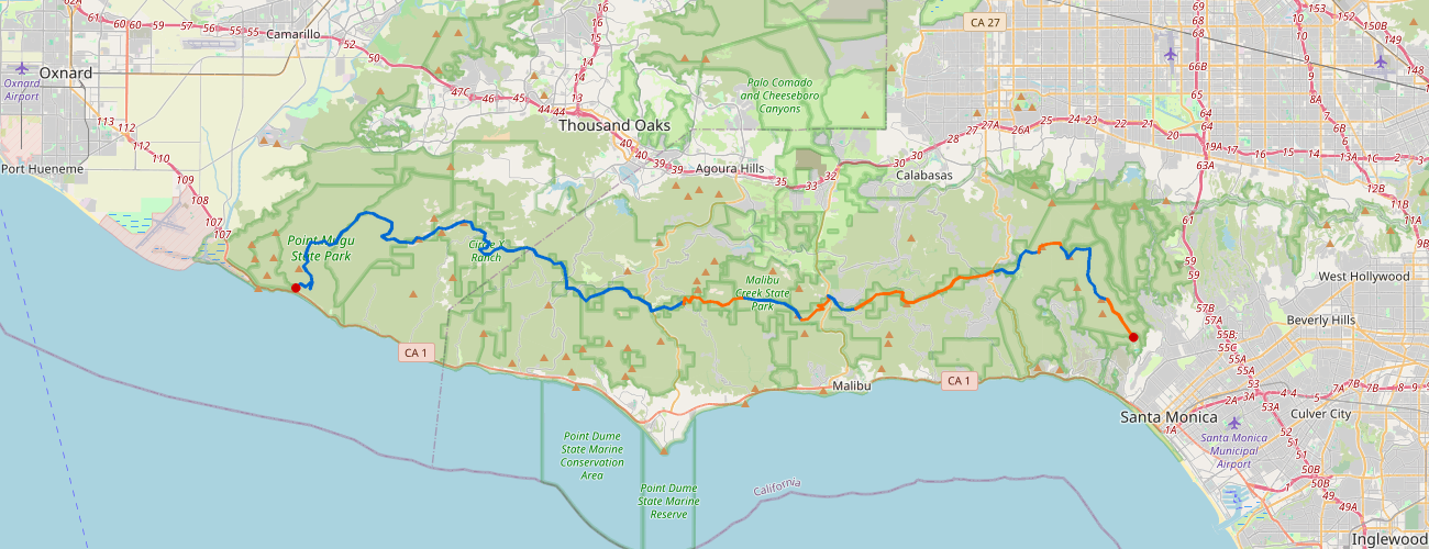
| Segment | Status | ~Mi | Progress | Profile (W→E) |
|---|
| Segment 1: Ray Miller TH to Danielson Ranch |
⬜ Not started
|
7.9 |
0 mi (0%)
|
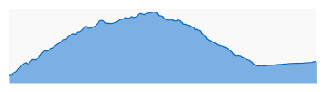 |
| Segment 2: Mishe Mokwa TH to Danielson Ranch |
⬜ Not started
|
8.4 |
0 mi (0%)
|
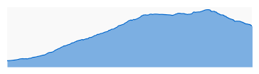 |
| Segment 3: Mishe Mokwa TH to Encinal Canyon Road |
⬜ Not started
|
10.2 |
0 mi (0%)
|
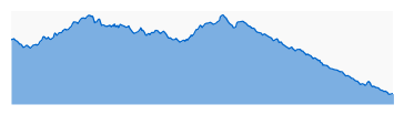 |
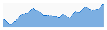
| Segment 4: Encinal Canyon Road to Latigo Canyon Road |
🔶 Partial
|
7.1 |
0.03 mi (0%)
|
 |
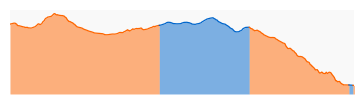
| Segment 5: Latigo Canyon Road to Piuma TH |
🔶 Partial
|
9.7 |
6.89 mi (71%)
|
 |
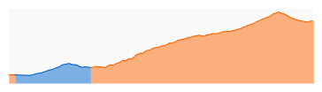
| Segment 6: Saddle Peak to Piuma TH |
🔶 Partial
|
7.2 |
5.3 mi (74%)
|
 |
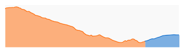
| Segment 7: Saddle Peak to Trippet Ranch |
🔶 Partial
|
5.9 |
4.78 mi (81%)
|
 |
| Segment 8: Trippet Ranch to Will Rogers State Park |
🔶 Partial
|
10.4 |
3.52 mi (34%)
|
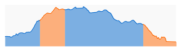 |
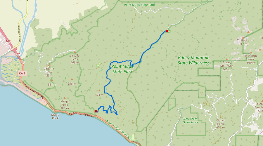
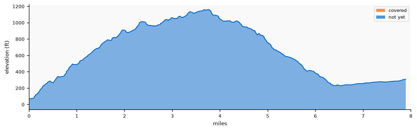
Segment 1: Ray Miller TH to Danielson Ranch
| ~Miles |
Covered |
Status |
| 7.9 |
0 mi (0%)
|
⬜ Not started
|
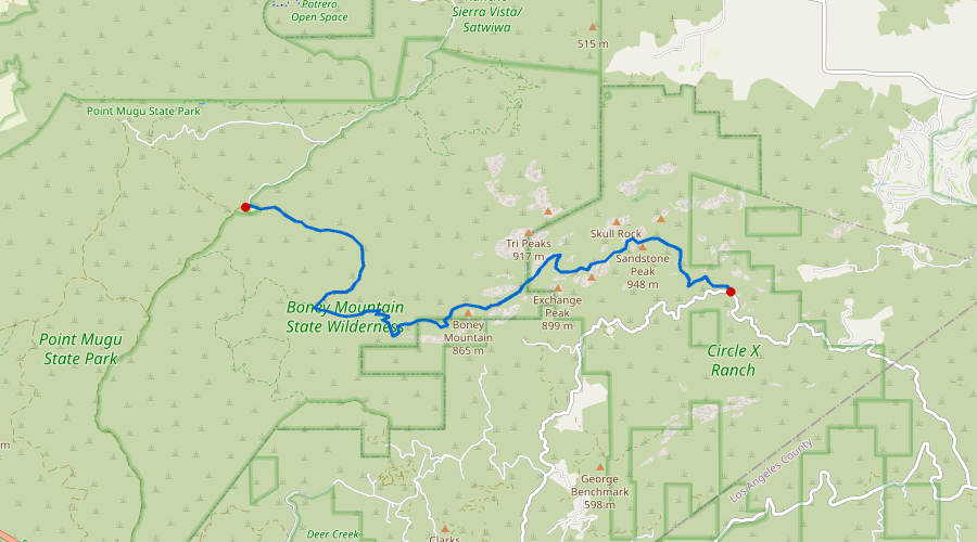
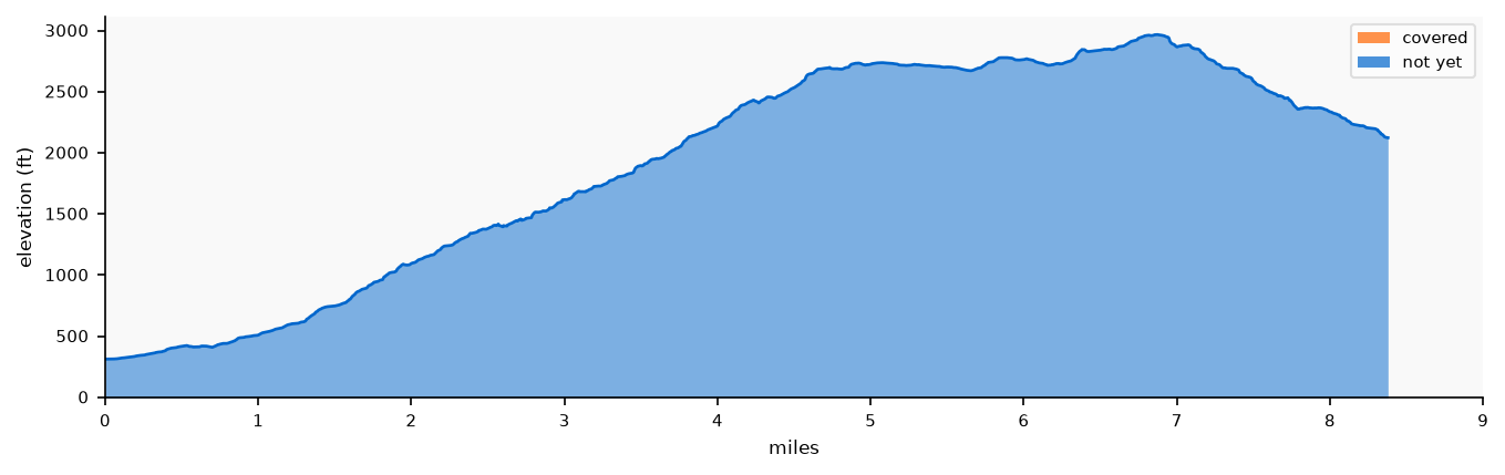
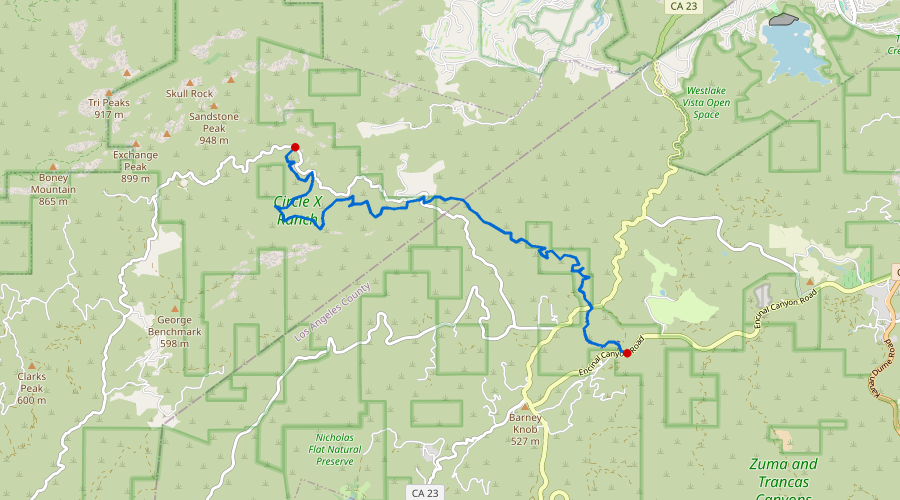
Segment 2: Mishe Mokwa TH to Danielson Ranch
| ~Miles |
Covered |
Status |
| 8.4 |
0 mi (0%)
|
⬜ Not started
|
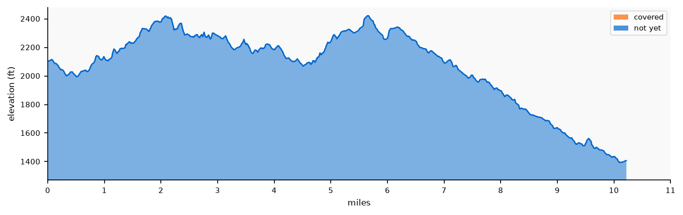
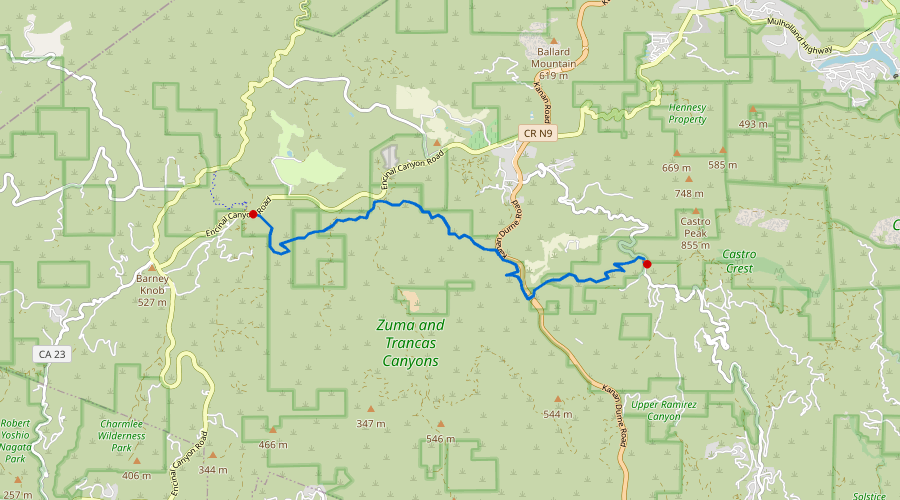
Segment 3: Mishe Mokwa TH to Encinal Canyon Road
| ~Miles |
Covered |
Status |
| 10.2 |
0 mi (0%)
|
⬜ Not started
|
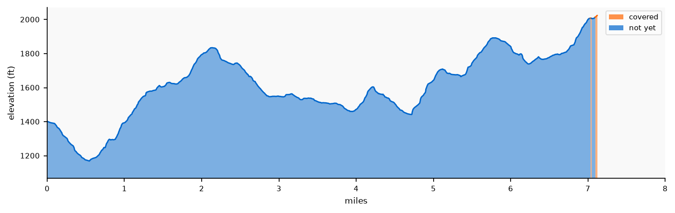
Segment 4: Encinal Canyon Road to Latigo Canyon Road
| ~Miles |
Covered |
Status |
| 7.1 |
0.03 mi (0%)
|
🔶 Partial
|
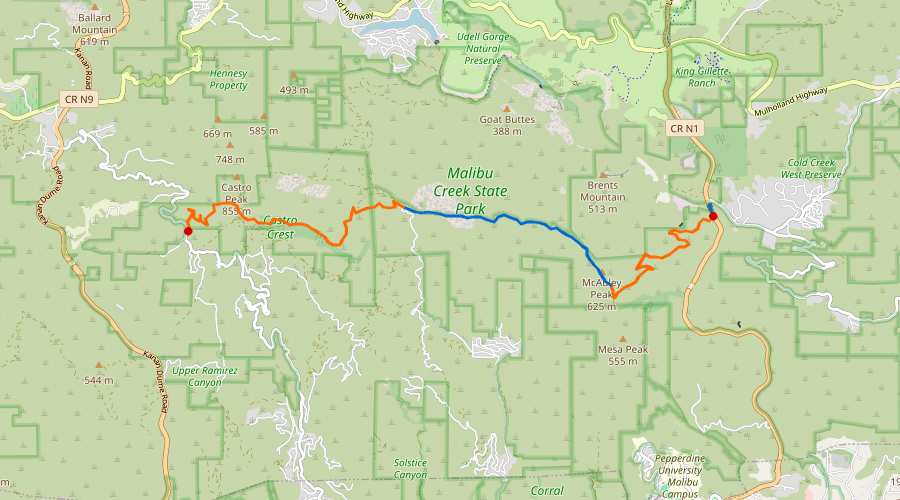
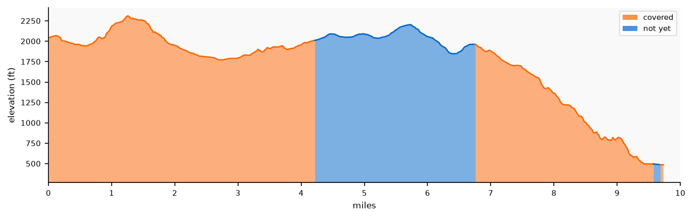
Segment 5: Latigo Canyon Road to Piuma TH
| ~Miles |
Covered |
Status |
| 9.7 |
6.89 mi (71%)
|
🔶 Partial
|
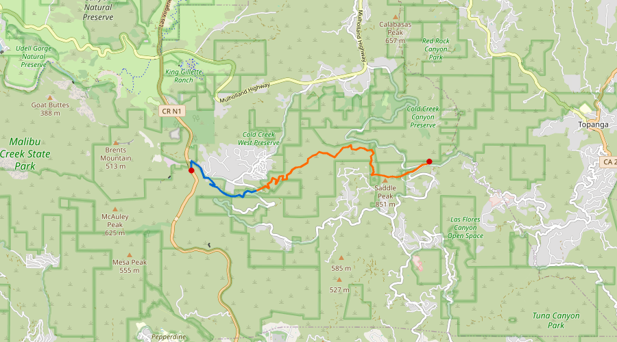
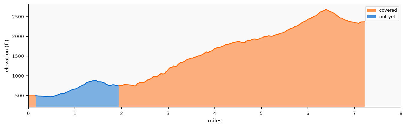
Segment 6: Saddle Peak to Piuma TH
| ~Miles |
Covered |
Status |
| 7.2 |
5.3 mi (74%)
|
🔶 Partial
|
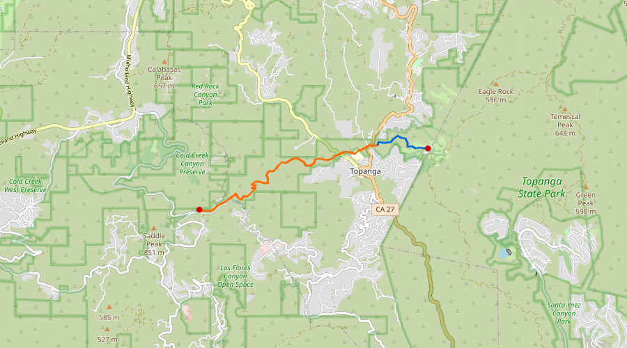
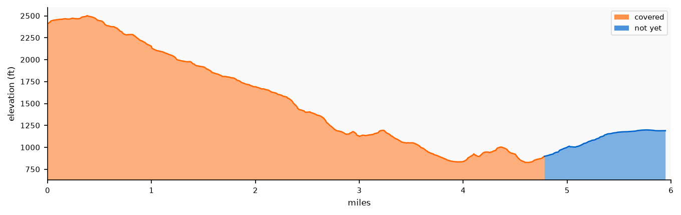
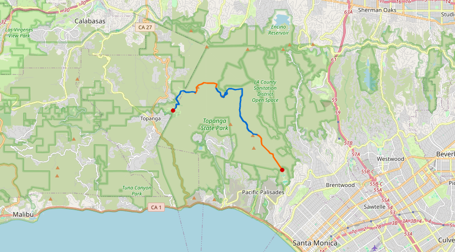
Segment 7: Saddle Peak to Trippet Ranch
| ~Miles |
Covered |
Status |
| 5.9 |
4.78 mi (81%)
|
🔶 Partial
|
Segment 8: Trippet Ranch to Will Rogers State Park
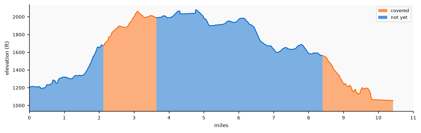
| ~Miles |
Covered |
Status |
| 10.4 |
3.52 mi (34%)
|
🔶 Partial
|
Sullivan Canyon / Westridge / Mandeville Canyon
The eastern SM Mountains. Sullivan Canyon and Mandeville Canyon drain south from the ridgeline toward Brentwood. Westridge fire road runs along the top between them and connects to the BBT ridge near Will Rogers SHP.
Runs: 17 | Miles: 129.1
| Date | Route | Miles | ↑ ft | Notes |
|---|
| 2009-12-15 |
Sullivan Fire Road from Encino Hills |
6 |
636 |
|
| 2011-10-30 |
Sullivan Canyon from Bayliss |
6.3 |
801 |
|
| 2023-04-22 |
Sullivan Canyon to Westridge Loop |
10.8 |
1,888 |
|
| 2023-06-16 |
Sullivan Canyon to Westridge Loop |
10.5 |
1,938 |
|
| 2023-06-20 |
Sullivan Fire Road Exploring |
6.4 |
1,696 |
|
| 2023-06-24 |
Westridge Spur Trail Loop |
2.8 |
956 |
|
| 2023-06-25 |
Sullivan Canyon Loop |
8.9 |
1,875 |
|
| 2023-07-07 |
Westridge |
6.2 |
1,698 |
|
| 2023-07-09 |
W Mandeville Fire Road to Westridge |
10.4 |
2,056 |
|
| 2023-07-20 |
Westridge to West Mandeville Ridge Trail |
5.8 |
1,997 |
|
| 2023-07-29 |
Westridge to W Mandeville Ridge Trail |
5.5 |
1,831 |
|
| 2023-09-04 |
Sullivan Canyon to Westridge Loop |
10.5 |
2,467 |
|
| 2023-09-12 |
Sullivan Canyon |
5.2 |
1,746 |
|
| 2023-09-16 |
Mandeville to Westridge |
11 |
2,427 |
|
| 2023-09-23 |
West Mandeville Ridge Loop Clockwise |
6.7 |
2,200 |
|
| 2023-10-15 |
Westridge Out and Back |
9.8 |
2,866 |
|
| 2024-01-15 |
Westridge Out and Back |
6.3 |
1,967 |
|
Temescal Canyon
Temescal Gateway Park. Accessible from Sunset Blvd in Pacific Palisades and from the Valley via Reseda Blvd / Mulholland.
Runs: 2 | Miles: 19.1
| Date | Route | Miles | ↑ ft | Notes |
|---|
| 2009-12-06 |
Temescal Cyn Rd South from Reseda Blvd |
8 |
709 |
|
| 2009-12-29 |
Temescal Cyn Road Long |
11.1 |
1,051 |
|
Malibu Creek
Malibu Creek State Park. Accessible from Las Virgenes / Malibu Canyon Road. The BBT passes near the park's northern boundary.
Runs: 1 | Miles: 7.2
| Date | Route | Miles | ↑ ft | Notes |
|---|
| 2009-12-05 |
Malibu Creek SP from Mulholland & Las Virgenes |
7.2 |
639 |
|
Mulholland Drive
Dirt and paved Mulholland Drive runs east-west along the Santa Monica Mountains ridgeline. The Marvin Braude Mulholland Gateway Park provides trailhead access on the eastern end.
Runs: 3 | Miles: 19.6
| Date | Route | Miles | ↑ ft | Notes |
|---|
| 2009-12-04 |
Mulholland Drive East from Reseda Blvd |
5 |
528 |
|
| 2009-12-18 |
Reseda Blvd to Eagle Junction |
7.5 |
1,007 |
|
| 2026-06-21 |
Mulholland - Marvin Braude Gateway to Nike Missile Site |
7.1 |
810 |
|
Beaches
Runs: 2 | Miles: 18.6
| Date | Route | Miles | ↑ ft | Notes |
|---|
| 2023-05-20 |
Oceanfront from Will Rogers |
5.5 |
78 |
|
| 2023-11-05 |
Malibu Half Marathon |
13.1 |
848 |
|
Other
Runs: 2 | Miles: 9.1
| Date | Route | Miles | ↑ ft | Notes |
|---|
| 2011-04-10 |
Fryman Canyon |
6 |
1,017 |
|
| 2019-11-28 |
Pacific Palisades Turkey Trot 5k |
3.1 |
205 |
|
Appendix: BBT Coverage Ledger
Every run that touched the Backbone Trail, in chronological order, with net-new mileage (miles not previously covered by an earlier run) and cumulative progress toward the full ~67 mi.
| Date | Route | Net New Mi | Cumulative Mi | % of Trail |
|---|
| 2010-01-02 |
Latigo Canyon to Corral Canyon |
4.21 |
4.21 |
6.3% |
| 2010-02-13 |
Topanga SP from Reseda |
1.5 |
5.71 |
8.5% |
| 2023-07-15 |
Sullivan Canyon to Backbone Above Will Rogers |
0.3 |
6.01 |
9.0% |
| 2026-06-28 |
Rogers Road Trail and Inspiration Loop from Will Rogers SP |
1.72 |
7.73 |
11.5% |
| 2026-07-04 |
Old Topanga to Saddle Peak 10 |
4.89 |
12.62 |
18.8% |
| 2026-07-12 |
Los Angeles County Running |
5.27 |
17.89 |
26.7% |